YuanPu Tech
Product
Application
Contact us


RealityCapture software
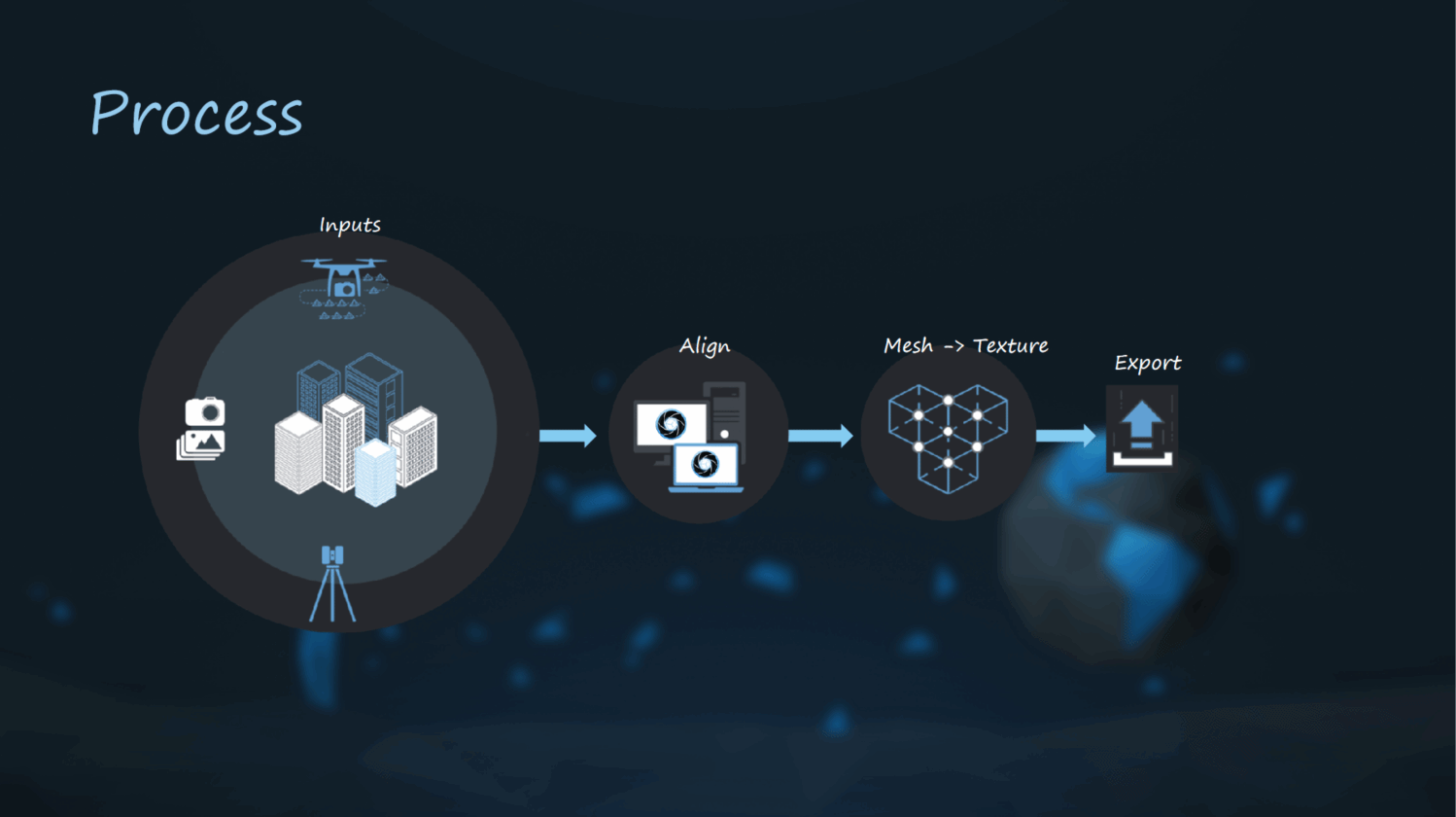
RealityCapture is the state-of-the-art photogrammetry software,
which is currently the fastest solution on the market.
·Outperforms all existing photogrammetry solutions in speed, accuracy, and mesh quality.
·The first software to allow a fully automatic combination of laser scans and photos.
·The only software which is able to mix lasers and photos easily without seams and
limitations.

Realitycapture features
·Automatic 3D model reconstruction of triangular mesh,
·Advanced coloring and texturing algorithms,
·Geo-registration into all world coordinate systems,
·Support for flight logs, GPS in EXIF/XMP, and ground control points,
·Ortho projections, DSM computation, and export into the recognized standards
such as tiff, geotiff,
·Volume, area, and distance measurements,
·Creation of geo-referenced maps and digital surface models,
·3D model export into standard formats (ply, obj, xyz),
·A set of tools for analyzing alignment quality and accuracy, geo-registration,
mesh reconstruction, 3D model post-processing (filtration, simplification, smoothing), etc.
·And many more..
Copyright ©2020 YuanPu Tech
津ICP备20004896号-2